Image of the Day…. Rare Ice Halo Display !!!

Rare ice halo display in New Mexico

Ice halo display captured by Joshua Thomas in Red River, New Mexico on the morning of January 9, 2015.

View larger. |  Halo display in Red River, New Mexico January 9, 2015.  Photo by Joshua Thomas.

The U.S. National Weather Service in Amarillo, Texas posted this photo on its Facebook page this weekend. Joshua Thomas in Red River, New Mexico captured these magnificent arcs in the sky on the morning of January 9, 2015. Look below for a labeled version of the same photo.

Ice halos are commonly seen by those who look at the skies; we receive several photos of ice halos from somewhere in the world every week, especially in wintertime. Often, we’ll receive many such photos, across a particular region, sometimes for several days in a row. Most ice halos appear as a circle or ring around the sun or moon. Sometimes, if conditions are just right, you do see these wonderful, rare events when the whole sky is filled with halo arcs.

Ice halos are caused by ice crystals in the upper atmosphere, which both refract and reflect sunlight or moonlight.

Read more: What makes a halo around the sun or moon?

SOURCE:::: http://www.earthsky.org

Natarajan

Jan 14 2015

Image of the Day…Liftoff of SpaceX Resupply Mission to the International Space Station …

SpaceX’s Falcon 9 rocket lifts off from Space Launch Complex 40 at Cape Canaveral Air Force Station carrying the Dragon resupply spacecraft to the International Space Station. Liftoff was at 4:47 a.m. EST on Saturday, Jan. 10, 2015. The commercial resupply mission will deliver 3,700 pounds of scientific experiments, technology demonstrations and supplies, including critical materials to support 256 science and research investigations on the space station.


SOURCE:::: www. nasa.gov

Natarajan

JAN 11 2015

Image of the Day… Satellite Picture of Snow Covered U.S. ….

Satellite Picture Shows Snow-covered U.S. Deep Freeze

NOAA’s GOES-East satellite provided a look at the frigid eastern two-thirds of the U.S. on Jan. 7, 2015, that shows a blanket of northern snow, lake-effect snow from the Great Lakes and clouds behind the Arctic cold front.

A visible picture captured at 11 a.m. EST showed the effects of the latest Arctic outbreak. The cold front that brought the Arctic air moved as far south as Florida, and stretched back over the Gulf of Mexico and just west of Texas. The image shows clouds behind the frontal boundary stretching from the Carolinas west over the Heartland. Farther north, a wide band of fallen snow covers the ground from New England west to Montana, with rivers appearing like veins. The GOES-East satellite image also shows wind-whipped lake-effect snows off the Great Lakes, blowing to the southeast. Meanwhile, Florida, the nation’s warm spot appeared almost cloud-free.

Image Credit: NASA/NOAA GOES Project  

SOURCE:::: http://www.nasa.gov

Natarajan

Jan 10 2015

Image of the Day…. View of Alps from Space …

View of the Alps From Space

Expedition 42 Flight Engineer Samantha Cristoforetti of the European Space Agency (ESA) took this photograph of the Alps from the International Space Station, andposted it to social media on Tuesday, Dec. 23, 2014. She wrote, “I’m biased, but aren’t the Alps from space spectacular? What a foggy day on the Po plane, though! #Italy”

Image Credit: NASA/ESA/Samantha Cristoforetti 

SOURCE:::: http://www.nasa.gov

Natarajan

International Space Station Astronaut Wakes up to an Incredible Sight from Space …

View image on Twitter

NASA astronaut Terry W. Virts woke up to an incredible sight from space Thursday morning — one he said was “better than any present” he could ask for.

“Sunrise on Christmas morning- better than any present I could ask for!!!!” tweeted Virts, who is currently aboard the International Space Station.


The image was widely circulated on the social media platform, amassing nearly 3,000 retweets and more than 4,200 favorites.

“So awesome,” one person tweeted back at him.

“Astonishing,” echoed another.

“What a view,’ wrote one more.

SOURCE:::  IN  www.theblaze.com

Natarajan

Christmas Greeting Message From International Space Station Astronauts …

Expedition 42 Commander Barry Wilmore and Flight Engineer Terry Virts send greetings and talk a little about their own Christmas Day in space.

Aboard the International Space Station, Expedition 42 Commander Barry Wilmore and Flight Engineer Terry Virts of NASA offered their thoughts and best wishes to the world for the Christmas holiday during downlink messages from the orbital complex on December 17. Wilmore has been aboard the research lab since late September and will remain in orbit until mid-March 2015. Virts arrived at the station in late November and will stay until mid-May 2015.

SOURCE:::: http://www.earthsky.org

Natarajan

Image of the Day… Colorful Christmas Island …

When Aqua flew over Christmas Island on Nov. 11, 2014, the MODIS instrument aboard took a visible picture of Christmas Island.
Image Credit: NASA Goddard MODIS Rapid Response

When Aqua flew over Christmas Island on Nov. 11, 2014, the MODIS instrument aboard took a visible picture of Christmas Island. Image Credit: NASA Goddard MODIS Rapid Response

A NASA satellite has captured a colourful photo of Christmas Island in the Southern Indian Ocean from space.

Christmas Island, an Australian Territory, is a coral atoll (a ring-shaped reef, island, or chain of islands made up of coral) in the northern Line Islands.

When NASA’s Aqua satellite flew over Christmas Island on November 11, 2014, the Moderate Resolution Imaging Spectroradiometer took a visible picture of the small atoll.

The island is only 135 square kilometres in area and has a tropical equatorial climate with a wet season that runs from December to April.

Although an Australian Territory, Christmas Island is located 2,600 km north-west of Perth, Western Australia.

The island is famous for land dwelling red crab which scramble to the sea each November to release eggs.

(This article was published on December 24, 2014)
SOURCE::::www.thehindubusinessline.com
Natarajan


Image of the Day… Frosty Slopes on MARS…!!!

This image of an area on the surface of Mars, approximately 1.5 by 3 kilometers in size, shows frosted gullies on a south-facing slope within a crater.

At this time of year, only south-facing slopes retain the frost, while the north-facing slopes have melted. Gullies are not the only active geologic process going on here. A small crater is visible at the bottom of the slope.

The image was acquired on Nov. 30, 2014, by the High Resolution Imaging Science Experiment (HiRISE) camera, one of six instruments on NASA’s Mars Reconnaissance Orbiter. The University of Arizona, Tucson, operates HiRISE, which was built by Ball Aerospace & Technologies Corp., Boulder, Colorado. NASA’s Jet Propulsion Laboratory, a division of the California Institute of Technology in Pasadena, manages the Mars Reconnaissance Orbiter Project for NASA’s Science Mission Directorate, Washington.

> More information and image products

Image Credit: NASA/JPL-Caltech/University of Arizona
Caption: Livio Tornabene, Ryan Hopkins, Kayle Hansen and Eric Pilles  

SOURCE:::: http://www.nasa.gov

Natarajan

Image of the Day…” Holiday Lights On the Sun …” !!!

Holiday Lights on the Sun: Imagery of a Solar Flare

The sun emitted a significant solar flare, peaking at 7:28 p.m. EST on Dec. 19, 2014. NASA’s Solar Dynamics Observatory, which watches the sun constantly, captured an image of the event. Solar flares are powerful bursts of radiation. Harmful radiation from a flare cannot pass through Earth’s atmosphere to physically affect humans on the ground, however — when intense enough — they can disturb the atmosphere in the layer where GPS and communications signals travel. This flare is classified as an X1.8-class flare. X-class denotes the most intense flares, while the number provides more information about its strength. An X2 is twice as intense as an X1, an X3 is three times as intense, etc.

> Video: Holiday Lights on the Sun

Image Credit: NASA/SDO 

SOURCE:::: http://www.nasa.gov

Natarajan

Astronaut’s-Eye View of NASA’s Orion Spacecraft Re-entry…

New video recorded during NASA’s Orion return through Earth’s atmosphere provides viewers a taste of what the vehicle endured as it returned through Earth’s atmosphere during its Dec. 5 flight test.
Image Credit:
NASA

New video recorded during the return of NASA’s Orion through Earth’s atmosphere this month provides a taste of the intense conditions the spacecraft and the astronauts it carries will endure when they return from deep space destinations on the journey to Mars.

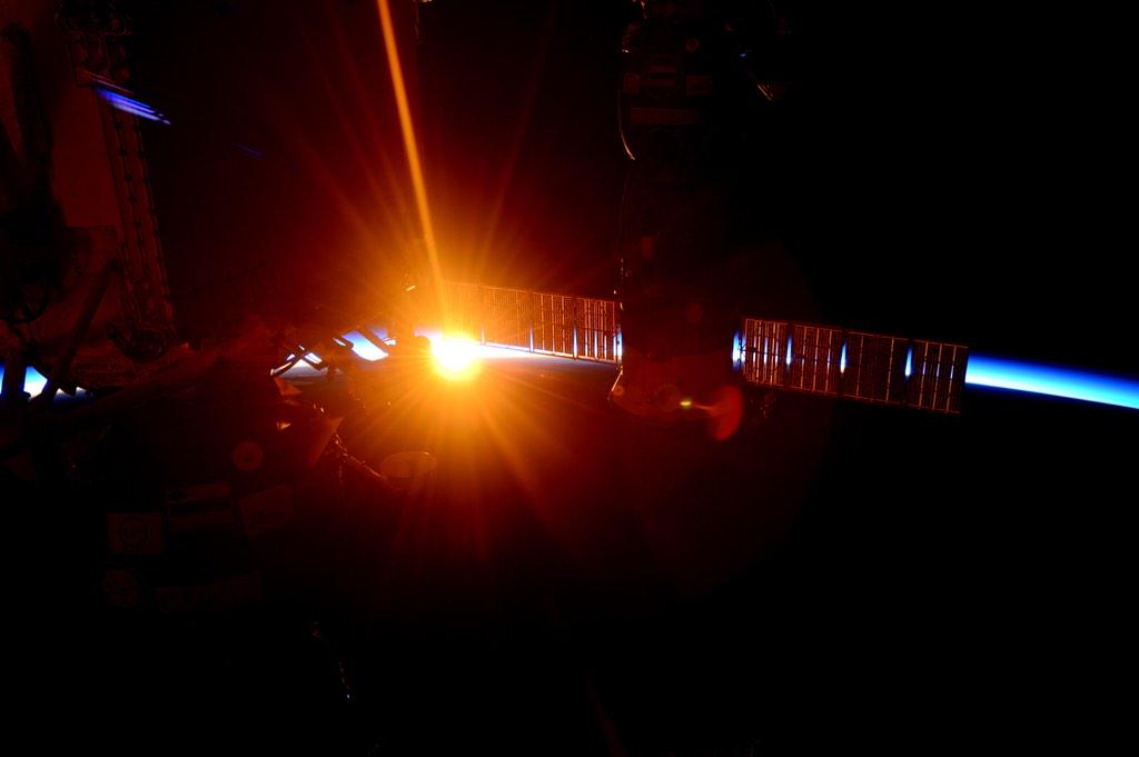
Among the first data to be removed from Orion following its uncrewed Dec. 5 flight test was video recorded through windows in Orion’s crew module. Although much of the video was transmitted down to Earth and shown in real time on NASA Television, it was not available in its entirety. Also, the blackout caused by the superheated plasma surrounding the vehicle as it endured the peak temperatures of its descent prevented downlink of any information at that key point. However, the cameras were able to record the view and now the public can have an up-close look at the extreme environment a spacecraft experiences as it travels back through Earth’s environment from beyond low-Earth orbit.

The video begins 10 minutes before Orion’s 11:29 a.m. EST splashdown in the Pacific Ocean, just as the spacecraft was beginning to experience Earth’s atmosphere. Peak heating from the friction caused by the atmosphere rubbing against Orion’s heat shield comes less than two minutes later, and the footage shows the plasma created by the interaction change from white to yellow to lavender to magenta as the temperature increases.

As Orion emerges safely on the other side of its trial by fire, the camera continues to record the deployment of the series of parachutes that slowed it to a safe 20 mph for landing and the final splash as Orion touched down on Earth.

NASA's Orion spacecraft is viewed by media at NASA's Kennedy Space Center, Fla. on Dec. 19, 2014.
NASA’s Orion spacecraft is viewed by members of the media at the Launch Abort System Facility at NASA’s Kennedy Space Center in Florida. Orion made the 8-day, 2,700 mile overland trip back to Kennedy from Naval Base San Diego in California. Analysis of date obtained during its two-orbit, four-and-a-half hour mission Dec. 5 will provide engineers detailed information on how the spacecraft fared. The Ground Systems Development and Operations Program led the recovery, offload and transportation efforts.
Image Credit:
NASA/Dimitri Gerondidakis

Orion was then retrieved by a combined NASA, U.S. Navy and Lockheed Martin team and carried back to shore aboard the Navy’s USS Anchorage. After returning to shore, it was loaded on to a truck and driven back to NASA’s Kennedy Space Center in Florida, where it arrived on Thursday.

Orion traveled 3,600 miles above Earth on its 4.5-hour flight test – farther than any spacecraft built for humans has been in more than 40 years. In coming back from that distance, it also traveled faster and experienced hotter temperatures – 20,000 mph and near 4,000 degrees Fahrenheit, to be exact. Orion will travel faster and experience even higher temperatures on future missions, when it returns from greater distances, but this altitude allowed engineers to perform a good checkout of Orion’s critical systems – in particular its heat shield.

Orion’s flight test was a critical step on NASA’s journey to Mars. Work already has begun on the next Orion capsule, which will launch for the first time on top of NASA’s new Space Launch System rocket and travel to a distant retrograde orbit around the moon.

To view the video of Orion’s re-entry, visit:

https://www.youtube.com/watch?v=MtWzuZ6WZ8E 

SOURCE::::www.nasa.gov

Natarajan