This Day in Science… Wright Brothers’ First Flight !!!

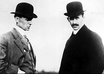
December 17, 1903. On this date, two Ohio brothers – Wilbur and Orville Wright – made the first bonafide, manned, controlled, heavier-than-air flight. It was the first airplane, and it took off at 10:35 a.m. with Orville Wright on board as pilot. He flew their vehicle, called theFlyer, for 12 seconds over 120 feet (about 37 meters) of sandy ground just outside Kitty Hawk, North Carolina.

One of the world’s most famous early photographs serves to commemorate the flight.

The Wright brothers' airplane on its first powered flight on December 17, 1903.  Via Library of Congress.

Wilbur and Orville Wright.

Two years later, the Wrights wrote in a patent application that their airplane design:

… provide[s] means for guiding the machine both vertically and horizontally … combining lightness, strength, convenience of construction, and certain other advantages.

Were the Wright brothers always destined for the skies? It’s known that their father gave them a rubber-band-powered flying toy when they were still children. The toy was made of cork and bamboo, with a paper body.

By 1899 – when Wilbur was 33 years old and Orville was 28 – the brothers were already learning everything they could about the science of aeronautics and the history of attempted human flight. Their first airplane were gliders, which they tested on the long, isolated beaches of Kitty Hawk. By 1902, they had built a glider that could be manned and controlled by a human pilot. It held a world record for gliding over 600 feet (nearly 200 meters).

Their first powered aircraft had a 40-foot (12-meter) wingspan, weighed 750 lbs, and had a 12-horsepower engine.

That first flight in December 1903 marked the beginning of a new era of global travel and relatedness.

By the way, at the time they received their patent for their airplane in 1906, several other aviators of the day claimed to have been the first to use the Wrights’ method of turning the airplane by warping or twisting the wings. But this part of the design, too, was included in the Wrights’ patent. In 2013, a story came to light about another would-be aviator, Gustave Whitehead, whose first flight supposedly beat the Wright brothers by two years. Thus far, that story has not been supported and is not accepted by aviation scholars.

Bottom line: The first airplane soared for 12 seconds over 120 feet (about 37 meters) of sandy ground just outside Kitty Hawk, North Carolina on December 17, 1903.

SOURCE:::: http://www.earthsky.org

Natarajan

Image of the Day…Sunset Over the Gulf of Mexico…

Sunset Over the Gulf of Mexico

From the International Space Station, Expedition 42 Flight Engineer Terry W. Virts took this photograph of the Gulf of Mexico and U.S. Gulf Coast at sunset and posted it to social media on Dec. 14, 2014.

The space station and its crew orbit Earth from an altitude of 220 miles, traveling at a speed of approximately 17,500 miles per hour. Because the station completes each trip around the globe in about 92 minutes, the crew experiences 16 sunrises and sunsets each day.

Image Credit: NASA/Terry Virts 

SOURCE::::www.nasa.gov

Natarajan

Image of the Day…Mars Exploration Rover opportunity …

 Opportunity Pausing at a Bright Outcrop on Endeavour Rim, Sol 3854

NASA’s Mars Exploration Rover Opportunity is continuing its traverse southward on the western rim of Endeavour Crater during the fall of 2014, stopping to investigate targets of scientific interest along way.  This view is from Opportunity’s front hazard avoidance camera on Nov. 26, 2014, during the 3,854th Martian day, or sol, of the rover’s work on Mars. This camera is mounted low on the rover and has a wide-angle lens.

The scene includes Opportunity’s robotic arm, called the “instrument deployment device,” at upper left. Portions of the pale bedrock exposed on the ground in front of the rover are within the arm’s reach. Researchers used instruments on the arm to examine a target called “Calera” on this patch of bedrock.  The wheel tracks in the scene are from the drive — in reverse — to this location, a drive of 32.5 feet (9.9 meters) on Sol 3846 (Nov. 18, 2014).

Image Credit: NASA/JPL-Caltech  

SOURCE:::: http://www.nasa.gov

Natarajan

” SRI CHAKRAM ” Formation on Desert Sand ? …

ஶ்ரீ சக்ரம் (சுயம்பு )

Published on Dec 1, 2014

அமெரிக்காவின் ஒரெகன் மாநிலத்தின் ஸ்டீன்ஸ் மலைகளின் தென்கிழக்குல் உள்ள இடம்தான் மிக்கி பேசின் சூரியனின் வெப்பத்தில் மணல் கொப்பளிக்கும் அளவுக்கு பாலைவன தேசம்.பில் மில்லர் என்கிற ராணுவ அதிகாரி இந்த இடத்தை குட்டி விமானம் மூலம் கடந்து செல்கையில் 13.3 mile சதுர அளவுக்கு வரி வரியாக வரைபடம் போன்ற ஒன்றை கண்டார் ஏதோ நாட்டின் வரை படம் என்று நினைத்து அதை பற்றி ஆராய்ந்தவருக்கு பயங்கர அதிர்ச்சி காரணம் அது நம் இந்து மதத்தில் காலம் காலமாக வழிபடும் சிவ விஷ்ணு பராசக்தியை குறிக்கும் ஶ்ரீசக்கரம் தான் அவர் பார்த்தது தொடர்ந்து 30 நிமிடங்கள் வட்டமிட்ட பின்னே தான் அவரால் முழு சக்கரத்தையும் 1 தடவை சுற்ற முடிந்தது. இதை ப் போலவே வரைய அவர்களால் எவ்வளவு முயன்றும் (1990 to 2014) இன்று வரை முடியவில்லை காரணம் நாலாயிரம் அடி மேலே பறந்து பார்த்தால் தான் ஶ்ரீசக்கரம் என்றே தெரியும். UFO ஆராய்ச்சியாளர்கள் டான் நியுமேன்,ஆலன் டெக்ளர் இருவரும் இந்த இடத்தை செப் 15 ல் ஆய்வு செய்தனர் அந்த ஆய்வில் இந்த இடத்தை சுற்றியுள்ள எந்த பகுதியிலும் மனித கால் தடமோ வாகன வந்து சென்ற தடமோ இல்லை என்றும் மனிதனால் இது சாத்தியமே இல்லை என்றும் கருத்து தெரிவித்துள்ளனர்

SOURCE::: http://www.youtube.com

Natarajan

Image of the Day…”Colorful and Plankton-full Patagonian Waters” !!!

Late spring and summer weather brings blooms of color to the Atlantic Ocean off of South America, at least from a satellite view. The Patagonian Shelf Break is a biologically rich patch of ocean where airborne dust from the land, iron-rich currents from the south, and upwelling currents from the depths provide a bounty of nutrients for the grass of the sea—phytoplankton. In turn, those floating sunlight harvesters become food for some of the richest fisheries in the world.

The Visible Infrared Imaging Radiometer Suite (VIIRS) on Suomi NPP captured this view of phytoplankton-rich waters off of Argentina on Dec. 2, 2014. Scientists in NASA’s Ocean Color Group used three wavelengths (671, 551, and 443 nanometers) of visible and near-infrared light to highlight different plankton communities in the water. Bands of color not only reveal the location of plankton, but also the dynamic eddies and currents that carry them.

> More Information

Image Credit: Norman Kuring, NASA’s Ocean Color Group, using VIIRS data from the Suomi National Polar-orbiting Partnership

SOURCE:::www.nasa.gov

Natarajan 

Strange … But True !!!

The U.S. Accidentally Dropped An Atomic Bomb On South Carolina In 1958 !!!

The Cold War is over, but there are still plenty of remnants from its troubles across the American landscape. One major reminder of this era is the crater in Mars Bluffs, South Carolina, where the Air Force accidentally dropped an atomic bomb in 1958. This site was one of the biggest military blunders of the entire Cold War. It’s a miracle that no one was killed.

Walter Gregg and his family were minding their own business on March 11, 1958. Suddenly, a giant explosion out of nowhere rocked the property and nearly destroyed their house. After Gregg accounted for his family members (none of whom were injured), he wondered what exactly happened.

Unbeknownst to Gregg, on that same spring morning, a B-47 Stratojet was flying in the skies over his property. The bomber was on its way to the U.K. to take part in a war game exercise. At that time, all bombers in the air were required to carry an atomic payload. This was because of the off-chance that nuclear war broke out while they were in the air. This particular bomber carried a Mark 6 atomic bomb, like the one pictured below.

Luckily, this particular Mark 6 bomb did not have its nuclear rod inserted. Otherwise, what happened would have been much, much worse.

As the bomber passed over Gregg’s house, a warning light went off. Something was wrong with the bomb’s docking system. Apparently, the locking pin was not engaged properly. That’s when navigator Captain Bruce Kulka went to investigate. However, while he was trying to fix the locking pin, Kulka accidentally pressed the bomb’s emergency release.

The weight of the 8,500 pound bomb forced the bay doors open. The bomb plummeted towards the woods of Mars Bluff. When the bomb landed, it left a 75-foot-wide, and 30-foot-deep crater in the forest near Gregg’s house. Here is what the impact site looks like today.

Luckily, no one died in the explosion, but it did level several buildings on Gregg’s property and damage nearby houses. Just imagine how much worse it would have been if the bomb was armed with its nuclear material.

The military paid Gregg and his family $54,000 to rebuild what was destroyed by the bomb and to keep things quiet. It was also around this time when a new rule was put in place requiring planes to make sure that their payloads were locked before take-off.

You can still see some pieces of the original bomb dropped on Mars Bluff at a local museum.

Via: Atlas Obscura

Talk about a big “oopsie.” I can’t believe the flight crew didn’t think to check if the bomb was secured properly before taking off. This could have kicked off World War III if the bomb was actually armed with its nuclear rod. What a simple mistake. Luckily, we’re all around now to laugh about it.

SOURCE::::www.viralnova.com
Natarajan


Image of the Day…Super Guppy Aircraft in NASA Hangar !!!

Super Guppy Spends a Restful Night in the NASA Langley Hangar

NASA’s Super Guppy aircraft, designed to transport extremely large cargo, rests after making a special delivery to the NASA Langley Research Center in Hampton, Virginia. The aircraft measures more than 48 feet to the top of its tail and has a wingspan of more than 156 feet with a 25-foot diameter cargo bay – the aircraft features a hinged nose that opens 110 degrees.

A representative test article of a futuristic hybrid wing body aircraft will be unloaded from the Super Guppy on Friday, Dec. 12 at Langley Research Center. The large test article, representing the uniquely shaped fuselage cross-section, is made out of a low-weight, damage-tolerant, stitched composite structural concept called Pultruded Rod Stitched Efficient Unitized Structure, or PRSEUS. Langley’s Combined Loads Test System will subject the revolutionary carbon-fiber architecture test article to conditions that simulate loads typically encountered in flight.

Image Credit: NASA 

SOURCE::::www.nasa.gov

Natarajan

Image of the Day…” Father , Son and The Moon …” !!!

The father, the son and the moon

Silhouette of statue in Sweden, under a waning moon, by a master sky photographer.

Photo by Göran Strand.  Used with permission.  Thank you, Göran!

Astrophotographer Göran Strand captured this beautiful shot on November 11, 2014, in the early morning. It features the silhouette of bronze statue in Östersund, Sweden – titledFather and Son – made by artist Olof Ahlberg in 1917. The moon was in a waning gibbous phase that morning, as it was in this morning’s sky.

SOURCE:::: http://www.earthsky.org

Natarajan

Image of the Day…A View From International Space Station !!!

From the International Space Station, Expedition 42 Commander Barry Wilmore took this photograph of the Great Lakes and central U.S. on Dec. 7, 2014, and posted it to social media.

This week on the station, the Expedition 42 crew has been busy with medical science and spacesuit work while preparing for the arrival of SpaceX’s Dragon commercial cargo craft, scheduled to launch on Dec. 16 on a two day trip to the station before it is captured by the Canadarm2 and berthed to the Harmony node.

Image Credit: NASA/Barry Wilmore 

SOURCE::::www.nasa.gov

Natarajan

Image of the Day…Incredible Video of Dense Fog Over Dallas…

Video capture by a drone of dense fog with zero visibility on Tuesday, December 9, in Dallas, Texas. Amazing visuals!


What happens when it’s so foggy outside, you can’t see anything? Simple. You grab a drone, fly it into the air and use it to capture some amazing video. Mike Prendergast posted an aerial view of today’s dense fog – December 9, 2014 – in Dallas, Texas. The footage is incredible. Check it out above!

On Tuesday, December 9, a dense fog advisory was issued for parts of the Dallas/Fort Worth area. Visibility was less than a quarter of a mile across a good bit of northeast Texas. According to observations at the Dallas/Fort Worth International Airport, visibility dropped to zero for three hours from 7 to 10 a.m. CST. In conditions like this, it’s nearly impossible to drive.

The fog continued after 10 a.m. CST, so the National Weather Service at Fort Worth extended the dense fog advisory until noon.

The fog was so dense that it affected flights out of the Dallas/Fort Worth International Airport. Several delays were reported as runway visual range showed airfield visibility down to 700-1000 feet.

Dense fog over Dallas, Texas. Image Credit: Mike Alvstad

Dense fog over Dallas, Texas. Image Credit: Mike Alvstad

Bottom line: What do you do when you have a drone and a ton of fog? If you do what Mike Prendergast did, you’ll capture amazing footage in high definition of a rare sight to see.

source::::  in http://www.earthsky.org

Natarajan